
Qualifications
ProQual Level 6 Diploma in Utility Mapping and Surveying Management
The ProQual Level 6 utility mapping qualification is the highest in the utility surveying pathway. Designed for experienced professionals in geomatics and site surveying who are ready to lead teams, manage projects and drive operational excellence across infrastructure development and civil engineering programmes.
Level
Level 6 (QCF/RQF)
Awarding Body
ProQual Awarding Body
Pricing
Price on application
Equipment
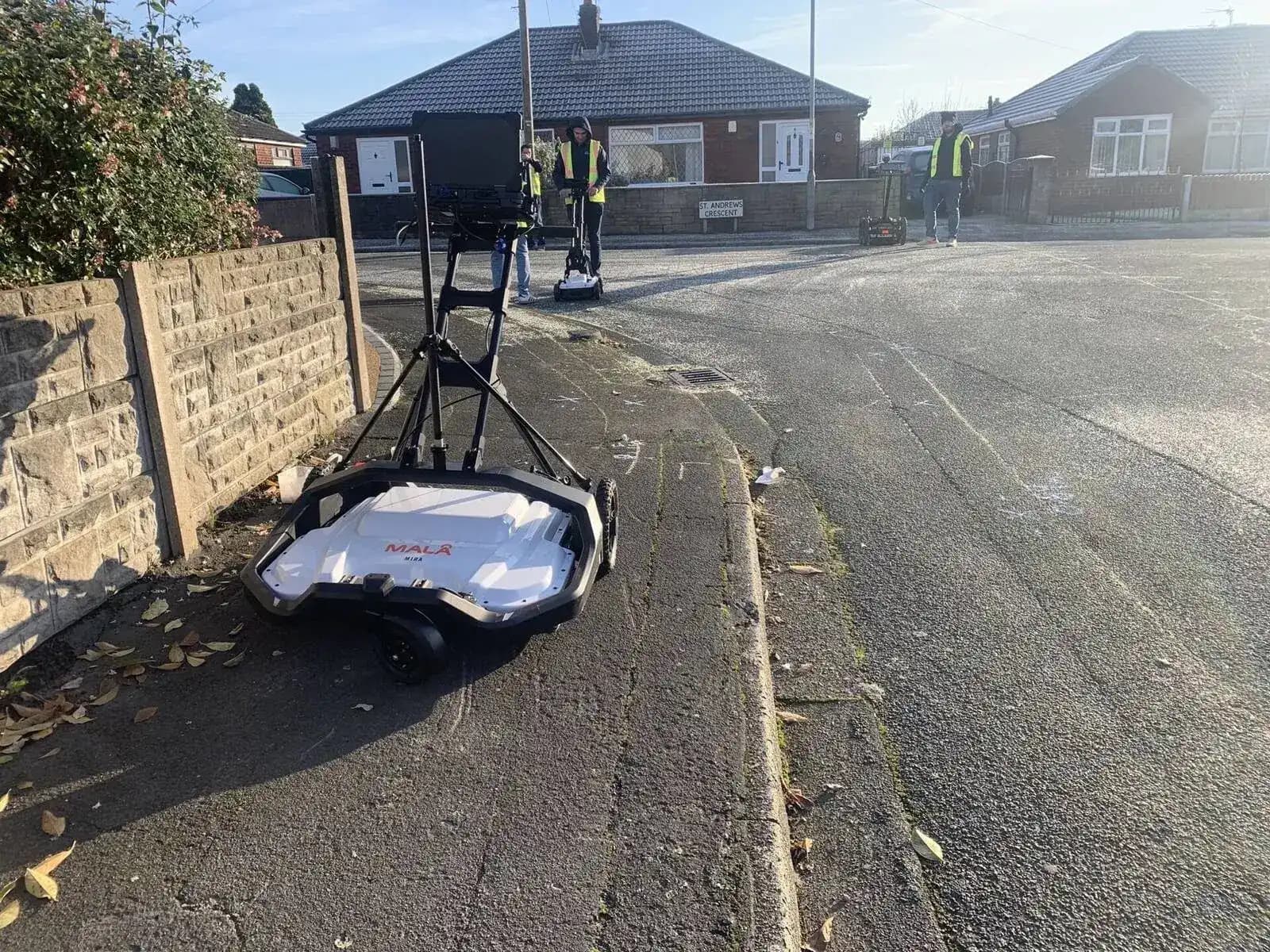
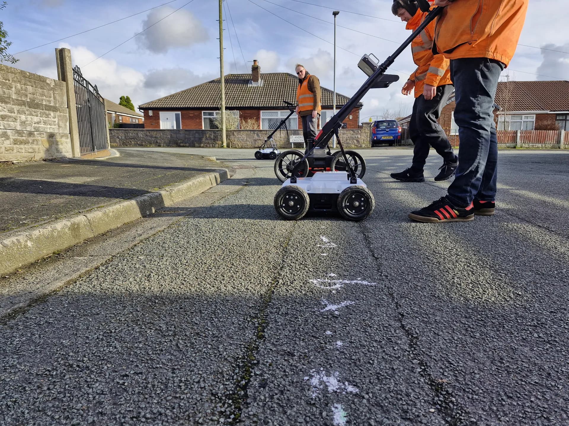
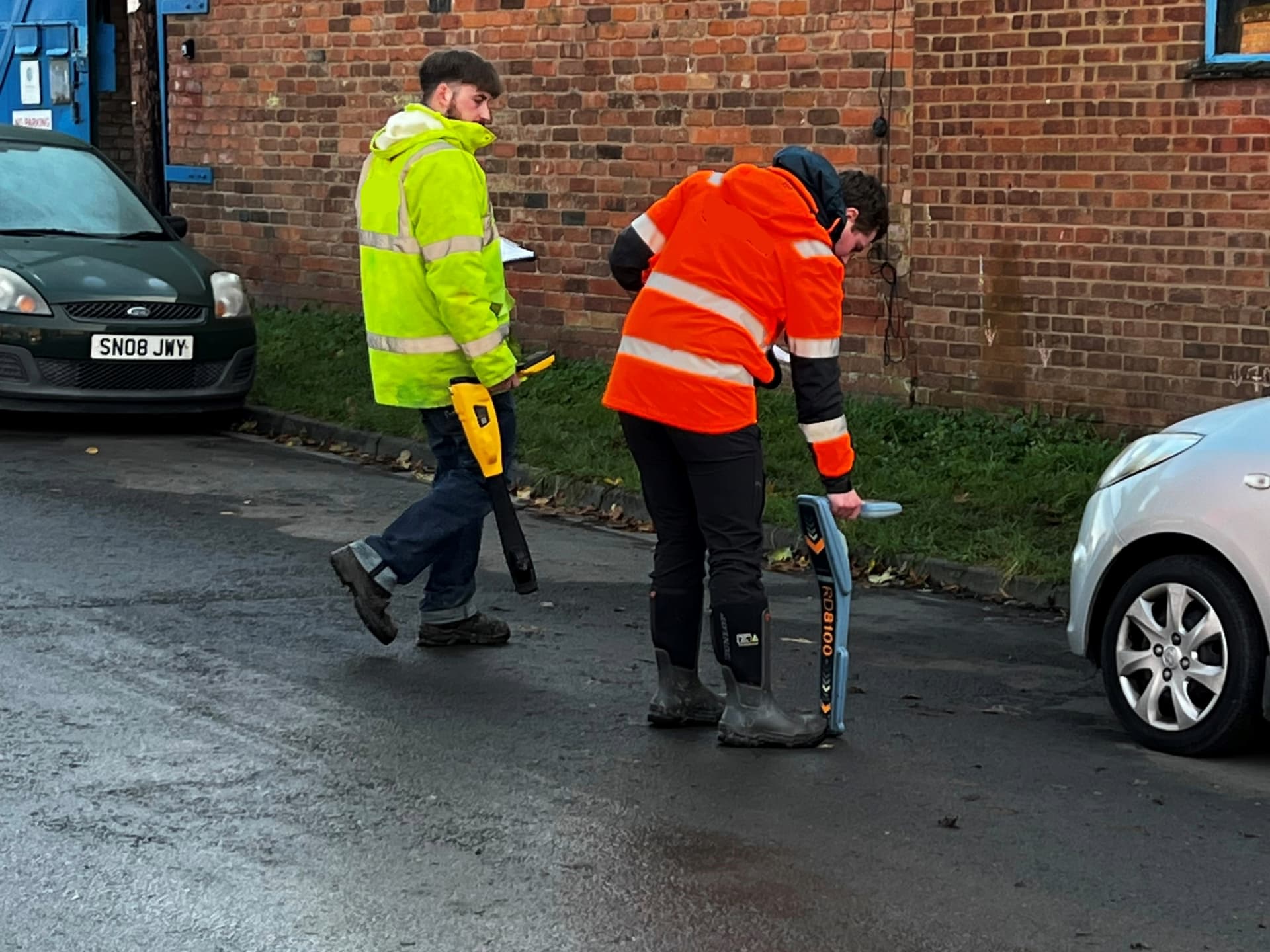
MALA GPR, Leica DSX, Radiodetection RD8200
Prerequisites
Level 3 + Level 4 + Level 5 required
The Qualification
What Is the ProQual Level 6 Diploma in Utility Mapping and Surveying Management?
The ProQual Level 6 Diploma in Utility Mapping and Surveying Management is the highest qualification available in the ProQual utility surveying pathway. It is designed for experienced professionals who are ready to step into a site surveying management, supervisory or technical leadership role within utility mapping and surveying operations. The diploma covers the management of site surveying across civil engineering, infrastructure development and construction projects, including the oversight of spatial data, mapping data and underground utility asset management.
Where Level 3 builds the foundation, Level 4 advances technical EM and GPR skills, and Level 5 demonstrates full PAS128 surveying competency, Level 6 is about managing the people, processes and performance that make site surveying operations work. Qualification candidates learn to plan site surveying processes, identify mapping and data requirements, present spatial data to project stakeholders and produce mapping data that meets industry standards for geomatics and site surveying.
The qualification is delivered on a portfolio basis covering mandatory units aligned to the learning outcomes for site surveying management. There are no exams. Candidates compile evidence of competency from their own workplace practice, supported by their Sygma assessor throughout the process. Portfolio evidence is drawn from real site surveying operations and demonstrates your ability to manage utility mapping projects, control risks and identify hazards in a working environment.
This qualification is for you if...
Audience
Who Is This Qualification For?
Survey Team Leaders
Experienced professionals now responsible for managing a team of utility mapping operatives on site surveying projects or across multiple contracts. The diploma validates your ability to plan site surveying and manage site surveying operations.
Project Managers
Project managers overseeing utility mapping or PAS128 survey projects end-to-end, including client relationships, project requirements, mapping data deliverables and programme management across civil engineering and infrastructure projects.
Operations Managers
Overseeing utility mapping business operations, including quality assurance, regulatory compliance, asset management, resource planning and site surveying service delivery. Operations manage the full cycle from underground utility detection through to presenting spatial data to clients.
Senior Surveyors Moving Into Management
Level 5 qualified utility surveyors ready to formalise their site surveying management expertise, develop advanced knowledge of geomatics and site surveying, and move into a recognised senior or leadership grade.
Training and Assessment Roles
Practitioners moving into internal training, mentoring or workplace assessment functions within a utility mapping operation, including those responsible for identifying hazards, implementing risk reduction methods and managing health and safety aspects of site surveying.
Contractors and Framework Operators
Contractors on major infrastructure development frameworks and construction projects where a Level 6 management qualification in geomatics and site surveying supports contract compliance and quality audit requirements.
Entry requirements: ProQual Level 3 Certificate, Level 4 Diploma, and Level 5 Diploma in Utility Mapping and Surveying. All three preceding qualifications must be in place before enrolment on the Level 6.
Competency Areas
What the Level 6 Diploma Covers
The ProQual Level 6 Diploma is built on portfolio-based evidence drawn from your own workplace. The content detailed curriculum structure covers mandatory units mapped to the management of site surveying operations at a senior level, with learning outcomes spanning geomatics and site surveying management.
| Management Area | What It Demonstrates |
|---|---|
| Managing Survey Operations | Planning and overseeing utility mapping programmes, allocating resources for site surveying, monitoring progress and ensuring PAS128 deliverable quality across all Quality Levels (A through D). Demonstrates the ability to plan site surveying processes and manage site surveying operations understand project requirements. |
| Project and Programme Management | Managing utility mapping projects from inception to closeout across civil engineering and construction projects, including programme planning, stakeholder liaison, risk management, project requirements and handover of survey reports, mapping data and spatial data. |
| Health, Safety and Legal Compliance | Ensuring site surveying operations comply with current legislation, CDM 2015, PAS128, HSG47 and applicable network operator requirements. Managing health and safety aspects including the ability to identify hazards, control risks and implement risk reduction methods within a site surveying context. Covers risk assessment and regulatory compliance for underground utility detection operations. |
| Quality Management and Assurance | Establishing and maintaining quality assurance processes for geospatial data collection, accurate utility mapping, report production and deliverable accuracy. Managing quality audit findings and implementing corrective actions. Produce mapping data to industry standards and present mapping data understand project requirements. |
| Team Leadership and Development | Leading, supervising and developing a team of utility surveyors. Managing performance, supporting CPD, conducting reviews and developing training plans within a site surveying operation. Communicate effectively with team members and stakeholders to ensure site surveying information flows across the operation. |
| Commercial and Client Management | Managing client relationships, contracts and commercial performance within utility mapping operations. Producing and reviewing tender submissions, scope documents and variation management. |
| Technical Oversight | Maintaining strategic technical oversight of electromagnetic location (EM), ground penetrating radar (GPR) and other advanced surveying techniques in use across the operation. Utilize advanced tools for underground utility detection and demonstrate technical expertise in site surveying management. |
| Data, Reporting and ICT | Overseeing the management of utility survey data, including geographic information systems, geospatial data analysis, complex data sets, spatial data outputs, CAD deliverables and e-portfolio or digital records management. Produce mapping data and detailed reports for asset management and infrastructure management purposes. |
What You Get

Assessment Process
Portfolio-Based Assessment: No Exams
The ProQual Level 6 Diploma is assessed entirely through a portfolio of workplace evidence. There are no examinations or classroom-based assessments. Qualification candidates compile evidence from their day-to-day site surveying management practice and submit it through an e-portfolio system. The assessment covers all mandatory units within the diploma in utility mapping and surveying management.
Registration
You register with Sygma as your approved centre. Sygma registers you with ProQual and provides access to the e-portfolio platform and your dedicated assessor.
Assessor Briefing
Your Sygma assessor reviews the diploma criteria with you and agrees a personal evidence plan aligned to your current role and day-to-day responsibilities.
Evidence Collection
You build your portfolio over time, drawing on workplace evidence such as project records, quality audits, H&S documentation demonstrating how you identify hazards and control risks, training plans, client correspondence and technical reports from site surveying projects.
Assessor Reviews
Your assessor reviews your evidence at agreed intervals, providing professional discussion and feedback. Reviews can be conducted as workplace visits or remotely.
Internal Verification
Sygma's internal verifier conducts a quality check on your completed portfolio to ensure it meets ProQual standards before external verification.
ProQual Certification
ProQual's external verifier reviews the portfolio. On successful verification, your Level 6 Diploma certificate is issued by ProQual Awarding Body.
What Is Included
Full Support from Registration to Certificate
Your ProQual Level 6 Diploma registration with Sygma includes everything you need to progress through the portfolio. The qualification fee for the diploma in utility mapping and surveying management is fixed from the point of registration with no hidden charges. ProQual registration fees are charged separately.
Enquire About Level 6Included in your registration
Qualification Pathway
The Full ProQual Utility Mapping Pathway
The ProQual utility mapping and surveying pathway is the only end-to-end qualification route in the UK that takes a utility surveyor from practical skills at Level 3 through to site surveying management accreditation at Level 6 Diploma in utility mapping. Every level is delivered by Sygma, providing career pathway continuity in geomatics and site surveying.
| Level | Qualification | Focus |
|---|---|---|
| Level 3 | Certificate in Utility Mapping and Surveying | PAS128 Quality Levels D and C. The mandatory entry point. |
| Level 4 | Diploma in Utility Mapping and Surveying | Advanced EML and GPR Specialist. PAS128 Quality Level B. |
| Level 5 | Diploma in Utility Mapping and Surveying | Full PAS128 surveyor. ICES GEUS01-GEUS04. 5-day fast-track available. |
| Level 6 | Diploma in Utility Mapping and Surveying Management YOU ARE HERE | Management of utility surveying operations, teams and projects. The pinnacle of the pathway. |

Why Sygma
Why Complete Your Level 6 With Sygma
One Provider, Every Level
Sygma delivers every level of the ProQual utility mapping and surveying pathway from Level 3 through to the 6 Diploma in utility mapping management. There is no switching between providers, no duplication of evidence and no inconsistency in how your site surveying portfolio is assessed.
Assessors Who Know the Industry
Your assessor is a qualified utility surveying professional with technical expertise in site surveying management. They understand PAS128, ICES competency standards, industry standards and what a real management role looks like in practice across civil engineering and infrastructure development.
Workplace-Based Assessment
The ProQual Level 6 Diploma is built around what you already do in site surveying management. You do not need to attend a block of classroom training. Your portfolio evidence comes from your actual job managing site surveying operations.
Independent and Objective
Sygma is an independent training and assessment provider with no ties to any equipment manufacturer or survey company. Your site surveying portfolio is assessed on what works in practice for accurate utility mapping, not on any commercial interest.
Accredited Assessment Centre
Sygma is a ProQual Approved Assessment Centre. All portfolios are internally verified and submitted to ProQual through the official approval process.
Career Pathway Continuity
If you completed your Level 3, 4 or 5 with Sygma, your assessor already knows your background. The Level 6 Diploma in utility mapping portfolio builds on a coherent body of evidence from your full career in site surveying to date, supporting your career prospects in utility management.
Funding Support
CITB Employer Network
Sygma is a CITB Approved Training Organisation. If your business is registered with CITB, speak to your CITB Employer Network adviser about funding support for this qualification. Graduates of the ProQual Level 6 Diploma can apply for the Manager CSCS Card after passing the relevant CITB Health, Safety and Environment test, providing formal career recognition within the construction projects and civil engineering sector.
Contact us for guidance on how to access available support. Funding is not guaranteed and varies by employer.
Related Courses
Expand Your Expertise
Level 5 Diploma
The highest operational qualification covering full PAS128 site surveying competency and practical skills in underground utility detection.
5-Day PAS128 Surveyor
Intensive training for the technical refresh of operational site surveying skills using advanced tools and utility mapping techniques.
TSA and ICES Utility Mapping
Full TSA and ICES training programme with ICES GEUS competency coverage.
Related Training
Training and Development That Complements the Level 6
While the ProQual Level 6 Diploma is assessed through portfolio evidence, several Sygma training options may provide useful evidence sources for site surveying management or help complete the prerequisite pathway.
TSA and ICES Utility Mapping Training Programme
Module completions can contribute evidence towards GEUS01-GEUS04 technical oversight units within the Level 6 portfolio.
Find out more ›PAS128 Awareness
Management-level understanding of PAS128 risk, legal liability, safety aspects and quality system requirements. A useful evidence source for quality assurance, regulatory compliance and managing health and safety units within the site surveying management portfolio.
Find out more ›5 Day PAS128 Surveyor Course
For Level 6 candidates who have not yet completed Level 5 formally, this intensive course fulfils the Level 5 prerequisite efficiently.
Find out more ›Bespoke and Corporate Training
Sygma designs bespoke management and technical briefing programmes for organisations seeking to develop multiple team members simultaneously, covering utility mapping techniques, asset management and infrastructure management.
Find out more ›Common Questions
Frequently Asked Questions
Do I need to complete Level 5 before enrolling on the ProQual Level 6 Diploma?
Yes. The ProQual Level 6 Diploma in utility mapping and surveying management requires the Level 5 Diploma as a prerequisite. To reach Level 5, you must also hold Level 3 and Level 4 in the utility mapping and surveying pathway. Sygma can assess your current qualifications and advise on the fastest route to Level 6 if you are at an intermediate stage of the geomatics and site surveying pathway.
How long does the ProQual Level 6 Diploma take to complete?
The time required varies depending on your current site surveying management role, the availability of evidence from your workplace and how quickly you work through the mandatory units and portfolio stages. Your Sygma assessor will agree a realistic timeline with you at the initial evidence planning session. Most qualification candidates complete the 6 Diploma in utility mapping over a period of several months of active evidence compilation from their site surveying operations.
How much does the Level 6 Diploma cost?
The Level 6 is priced on application. Contact Sygma directly for a fee proposal. The fee is fixed from the point of registration with no additional charges as you progress through the portfolio. ProQual registration fees are payable separately to ProQual Awarding Body.
Is the ProQual Level 6 Diploma assessed by exam?
No. The ProQual Level 6 Diploma in utility mapping and surveying management is assessed entirely through a portfolio of workplace evidence. There are no examinations, written tests or classroom assessments. Your site surveying evidence is reviewed by a Sygma assessor and then submitted to ProQual for external verification.
Can I do the Level 6 alongside my normal job?
Yes. The portfolio-based assessment model is specifically designed to fit around your working life. Your evidence comes from your actual management practice, so you are not required to attend extended training programmes. Assessor reviews can be conducted remotely, reducing time away from your role.
Does the ProQual Level 6 Diploma help with ICES and CSTMB accreditation?
The ProQual Level 6 Diploma demonstrates site surveying management competency at the highest level within utility mapping and surveying. While the diploma itself is a ProQual qualification, the evidence you compile may also support ICES or CSTMB membership applications at senior grades, enhancing your career prospects as an experienced professional. Speak to your Sygma assessor about how to structure your portfolio to maximise its value across multiple industry standards frameworks.
What career progression does the Level 6 Diploma support?
Career progression from the ProQual Level 6 Diploma can include roles such as Senior Utility Surveyor, Project Manager, Operations Director or Technical Director within the geomatics and site surveying sector. The diploma in utility mapping and surveying management emphasises both internal organisational processes and standard industry practices, making it recognised across civil engineering, infrastructure development and construction projects. Graduates can also apply for the Manager CSCS Card after passing the relevant CITB Health, Safety and Environment test.
What are the mandatory units in the Level 6 Diploma?
The ProQual Level 6 Diploma covers mandatory units across site surveying management including managing survey operations, project and programme management, health safety and legal compliance, quality management and assurance, team leadership and development, commercial and client management, technical oversight, and data reporting and ICT. Learning outcomes span the ability to plan site surveying processes, identify mapping and data requirements, present spatial data, produce mapping data, manage site surveying information and site surveying management identify and manage operational risks.
What practical skills and advanced surveying techniques does the Level 6 cover?
While the Level 6 is a management qualification, it requires you to demonstrate technical expertise and advanced knowledge of practical skills used in site surveying. This includes strategic oversight of ground penetrating radar, electromagnetic location and other advanced surveying techniques. You must show you can manage geospatial data collection, geospatial data analysis and the use of geographic information systems across different site surveying operations. The diploma also covers interpreting complex data from underground utility detection and ensuring accurate utility mapping through quality assurance frameworks to meet regulatory compliance requirements.
How does the Level 6 Diploma relate to civil engineering and infrastructure projects?
The ProQual Level 6 Diploma is directly relevant to project managers and operations managers working on civil engineering, construction projects and infrastructure development programmes. The site surveying management competencies cover asset management, utility infrastructure oversight, risk assessment, identifying hazards and implementing risk reduction methods to control risks across large-scale infrastructure management projects. Utility mapping and surveying plays a critical safety role in infrastructure projects, and the Level 6 qualification provides the advanced knowledge to manage these operations effectively while meeting project requirements.
Enquire About the ProQual Level 6 Utility Mapping Diploma
Price on application. Portfolio-based site surveying management assessment with dedicated assessor support from registration to certificate. Contact us to discuss your current qualifications and get a fee proposal for the ProQual Level 6 Diploma in utility mapping and surveying management.