Utility Mapping Training Bristol
Sygma Solutions delivers GPR training, PAS128 awareness and utility mapping qualifications to teams in Bristol and across the South West. Our courses teach delegates how to accurately map underground utilities using ground penetrating radar and electromagnetic locating equipment. With a partner training venue at The Survey School in Worcester and 21 years delivering specialist utility courses nationwide, we serve the South West market with both venue-based and on-site delivery options.
What We Deliver
Courses Available for Bristol and South West Teams
Sygma delivers the following utility mapping and GPR survey courses for teams in Bristol, Bath, Exeter, Plymouth, Swindon and across the South West. Each course covers the practical training and data collection techniques that utility surveyors need to accurately map underground utilities, buried services and underground infrastructure. Awareness and in-house courses can be delivered at your premises. Qualification-level courses are typically delivered at our partner venue at The Survey School in Worcester.
| Course | Delivery |
|---|---|
| GPR Module 1 (Ground Penetrating Radar Introduction) | At your premises or Worcester venue |
| GPR Module 2 (Post Processing and Data Interpretation) | At your premises or Worcester venue |
| PAS128 Awareness (For Commissioners of Utility Surveys) | At your premises or Worcester venue |
| ProQual Level 3 Diploma in Utility Mapping and Surveying | Worcester venue or Wigan HQ (venue attendance required) |
| 5-Day Surveyor Programme (Level 3 Fast-Track) | Worcester venue or Wigan HQ |
Why It Matters
Why Utility Mapping Training Matters for Construction and Excavation Projects
There are over 70,000 utility strikes per year in the UK. Every one of those strikes represents a failure in the survey process, a gap in knowledge, or a team that did not have the practical training to detect and accurately map underground utilities before breaking ground. Accidental damage to buried services causes project delays, costly repairs, service disruptions and potential hazards to workers and the public.
Accurate utility mapping is essential when planning construction, infrastructure maintenance or urban development activities. A thorough utility survey identifies the exact location and depth of underground features including water pipes, gas lines, electric cables, drainage systems and telecommunication infrastructure. Without reliable data from trained operators using the latest technology, excavation projects carry unacceptable levels of risk.
Utility mapping training gives your team the skills to carry out GPR surveys, electromagnetic locating and desktop study analysis to the standard required by clients, local authorities and principal contractors. The risk assessment benefits alone make training one of the most cost effective investments a contractor or utility surveyor can make.
Audience
Who Is This Training For?
Utility mapping and GPR training serves two distinct audiences in the South West. Whether your team needs to carry out utility surveys in the field or commission comprehensive utility survey programmes, Sygma delivers to both.
Field Operatives and Surveyors
Utility surveyors and field operatives who carry out GPR surveys, EML surveys or combined utility mapping programmes to detect underground utilities and buried utilities on site. The GPR Modules and Level 3 Diploma are for this group. The qualification pathway leads from GPR Module 1 through to Level 3 and beyond, building the accurate data collection and data processing skills that utility surveyors need.
Site Managers, Project Managers and Procurement Teams
The PAS128 Awareness course is designed for people who commission utility surveys but do not carry them out. Understanding the PAS128 Quality Levels, what a comprehensive utility survey actually contains, and how to specify project requirements correctly is increasingly required at client and principal contractor level.
If your team includes both, Sygma can deliver a combined programme. Contact us to discuss.
Technology
How Ground Penetrating Radar and Electromagnetic Locating Work
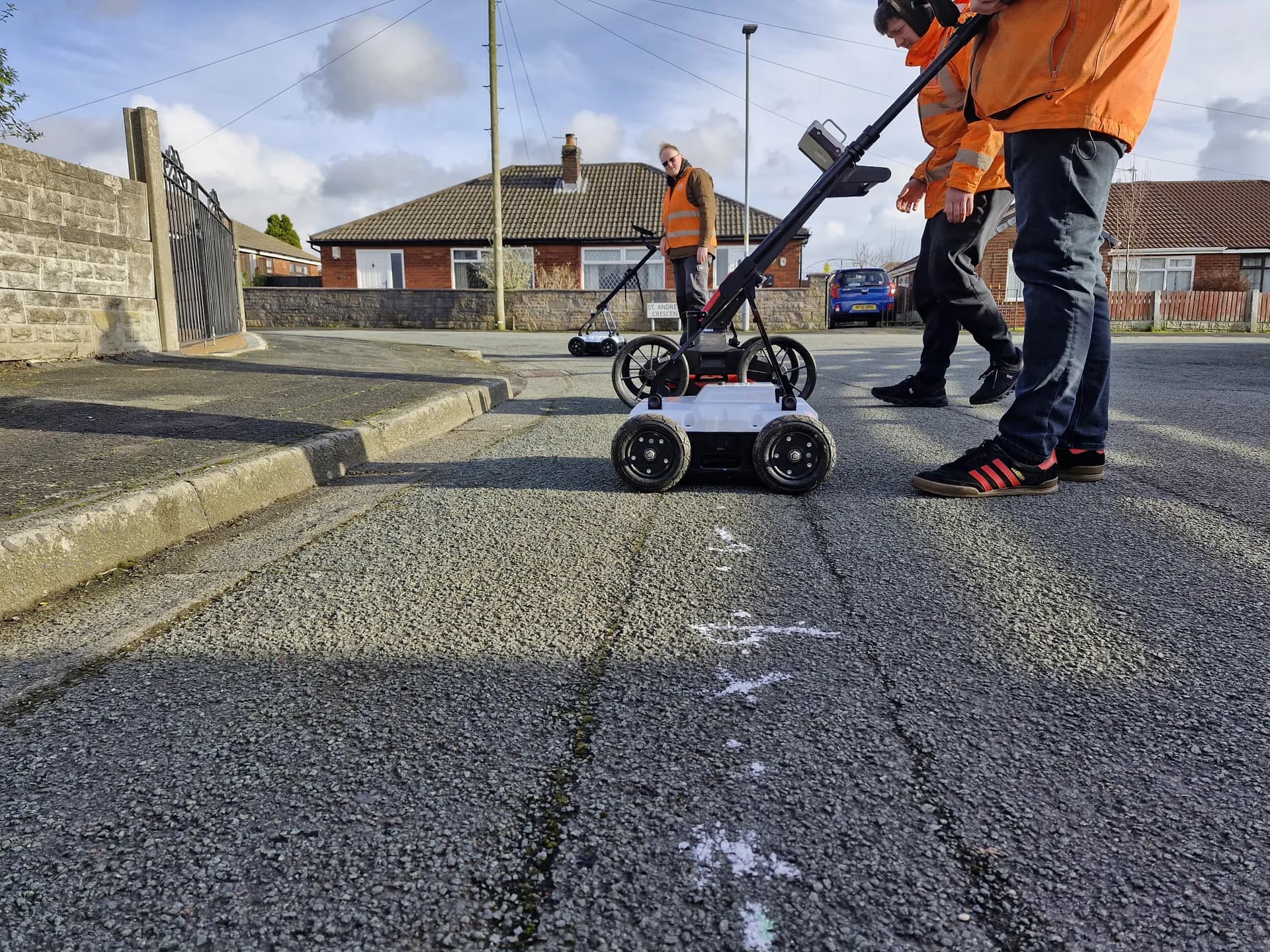
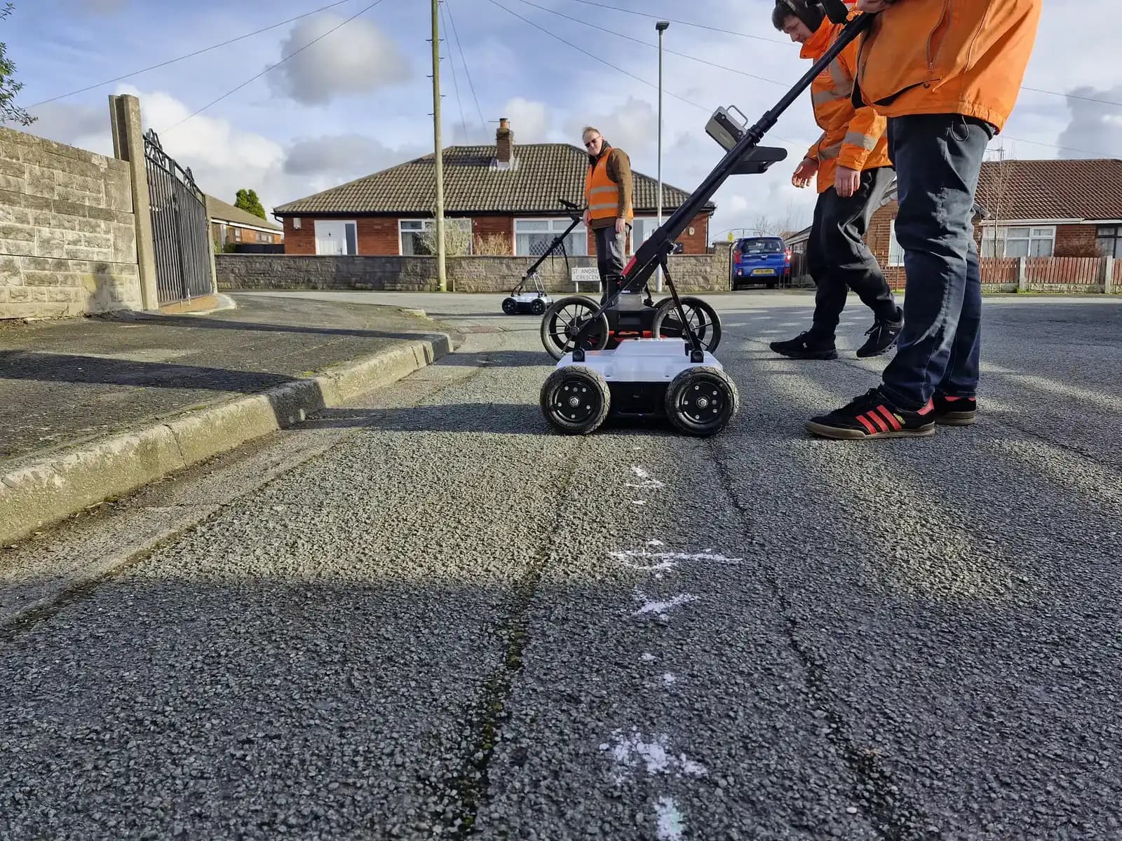
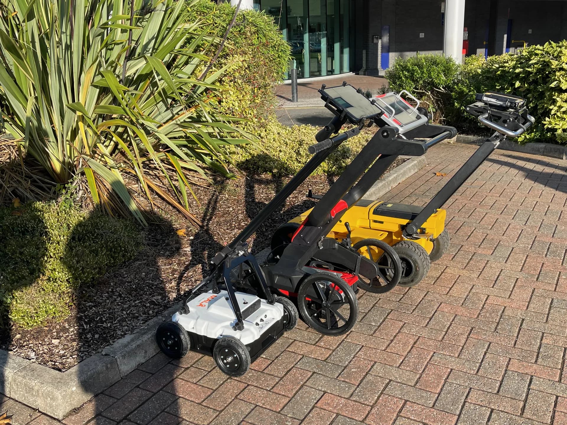
Ground penetrating radar (GPR) is a non-destructive survey method that emits high-frequency radio waves into the ground and analyses the reflected signals to detect subsurface objects and anomalies. GPR surveys can detect both metallic and non-metallic underground services, including plastic water pipes, drainage systems, underground storage tanks and underground structures that electromagnetic locating alone cannot find. GPR provides high-resolution imaging of underground features, making it essential for detailed mapping and accurate information about what lies beneath a site.
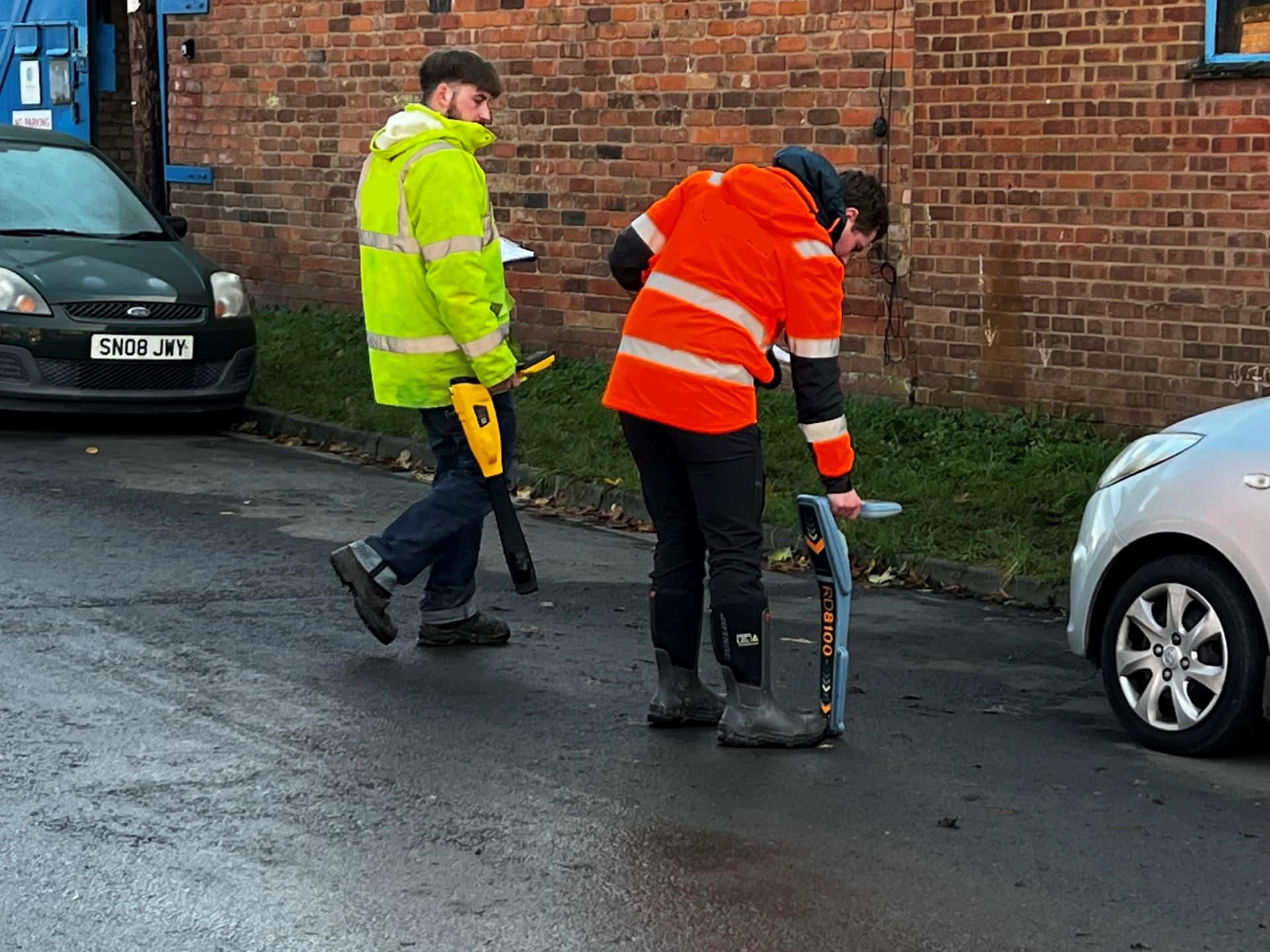
Electromagnetic locating (EML) uses passive detection and active signal tracing to identify conductive utilities such as metal pipes, electric cables and telecommunication infrastructure. Combining GPR and electromagnetic locating in a single survey programme gives utility surveyors maximum accuracy and the most reliable data across all ground conditions and site conditions.
Our GPR training courses cover data collection techniques, post processing of survey data using Object Mapper software, and the interpretation of detection results. Delegates learn how to map underground utilities accurately across different soil types and environments, giving them the advanced technology skills that clients and local authorities expect from experienced professionals.
Venue
Our Partner Training Venue in Worcester
Our partner training venue, The Survey School in Worcester, is approximately 60 miles from Bristol city centre, accessible via the M5. It provides the specialist equipment, advanced detection technologies and controlled assessment environment that qualification-level utility mapping courses require.
For GPR Module 1 and PAS128 Awareness, we offer flexible deployment and can come to your Bristol or South West premises for on-site delivery. For ProQual Level 3 and the 5-Day Surveyor Programme, Worcester is the standard delivery venue for South West clients. Contact us to discuss logistics and accommodation options.
Standards
Understanding PAS128 Quality Levels for Utility Surveys
The PAS128 standard categorises utility surveys into different Quality Levels that define the accuracy and detail of the survey data collected. From desktop study records at Quality Level D through to verified and precise positioning at Quality Level A, each level serves a different project scope and set of project requirements. Compliance with PAS128 is essential for ensuring safety and efficiency on construction, renovation and excavation projects.
PAS128-compliant surveys require a combination of desktop utility record searches and physical surveys using ground penetrating radar (GPR) and electromagnetic locating. Our PAS128 Awareness course teaches site managers, project managers and procurement teams how to specify surveys correctly, interpret survey data and make knowledge-based decisions about what Quality Level their development activities require.
Funding
CITB Funding for South West Contractors
Sygma Solutions is a CITB Approved Training Organisation. If your business is registered with CITB, you may be able to access funding support towards eligible training costs through the CITB Employer Network model. This can deliver significant cost savings for South West contractors investing in utility mapping training. Speak to your CITB Employer Network adviser about funding for this training, or contact Sygma and we can guide you through the process.
Progression
The Qualification Pathway for Utility Surveyors
Sygma provides ProQual accredited courses that create a clear progression route for utility surveyors working in the South West. Delegates typically start with GPR Module 1 to build practical training in ground penetrating radar data collection, before progressing to GPR Module 2 for post processing and survey data interpretation. The ProQual Level 3 Diploma in Utility Mapping and Surveying validates competence across the full survey process.
Our courses are aligned with industry recognised certifications including ProQual and EUSR. The training curriculum includes both theoretical knowledge and practical scanning techniques, covering advanced technology applications across different site conditions and ground types. For organisations that need trained operators quickly, the 5-Day Surveyor Programme provides a fast-track route to the same Level 3 qualification with consecutive-day delivery at our Worcester venue.
Common Questions
Questions About Utility Mapping Training in Bristol
Book or Enquire About South West Delivery
Tell us what your team needs and when. Whether you need a free, no-obligation initial consultation about utility mapping training or a firm quote for on-site delivery, we will confirm availability, venue options and respond within one working day.