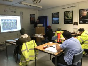
The theoretical part of our PAS128 Utility Mapping & Surveying Course can now be completed online through our live & interactive sessions.
Surveyors can now benefit from our comprehensive course without the costs incurred of losing them for 5 days, in fact for some options no time off site may be required!
This can include the ProQual Level 3 Utility Mapping Qualification as an add on option.
This course is mapped to the ICES competencies for Utility Mapping
The theory consists of 5 x 4-hour sessions, a selection of times and dates will be available to choose from with a selection available after hours to minimise site down time. (details below)
Once all theoretical sessions have been completed a practical session will be , these will be small numbers to allow enough time with our trainer/assessor. The delegates will be continually assessed throughout which will be documented.
3 choices are available below (select one):
1. Public practical session – 2 days at the Sygma Utility Mapping centre in Wigan
2. Public practical session – 2 days at The Survey School in Worcester.
3. Private practical session – This will be arranged at your premises or a site of your choice to be conducted “on the Job”
Finally, an online exam will be taken:
Pricing: There will be a fixed fee for the theory online and practical pricing will vary depending on location and numbers.
For beginners new to the industry who do not have a mentor in the workplace, we can offer additional practical sessions throughout the year on demand if necessary.
Furthermore, to benefit the industry at large, free places on the theoretical part may be offered to students/young people/job seekers to promote the industry and bring new people in.
Module 1 Part A – Online Theory – Desktop Survey & Site Reconnaissance PAS128 Level D & C (4 hours)
• Understand relevant specifications and standards relating to utility surveys and mapping e.g. PAS128 and PAS256.
• Obtain (either directly or from 3rd party), interpret and understand limitations of Statutory Undertakers records, service records and other available data and assessment of formal and other informal sources of information
Module 1 Part B – Online Theory – Desktop Survey & Site Reconnaissance PAS128 Level D & C (4 hours)
• Site reconnaissance & methods of identifying services prior to use of geophysical detection methods.
• Understand applicable licensing requirements, legislations and how it applies including CDM considerations; HSG47, NRSWA, Management Act and any other.
ICES GEUS01 A-D
Module 2 PART A – EM Locators basic theory – PAS128 Level B (EM)( 4 Hours)
• Electrical theory & circuits
• Effective use of the electromagnetic methods of locating services.
• Direct connection, induction clamp, Sonde, Induction, Passive modes
Module 2 PART B – EM Advanced Locating – PAS128 Level B (EM)(4 Hours)
• Field distortion – Peak/Null
• CD/CM & Depth
• Identify where use of alternative detection methods may be suitable or required, and how these techniques are applied.
• Seismic,Electrical resistivity, – Microgravity, etc.
• Geophysical methods: -Electromagnetic conductivity,
• Acoustic pipe detection methods
• Gyroscopic techniques
• Drainage CCTV surveys
ICES GEUS01 E&G
Module 3 – 1 Day GPR – PAS128 Level B (GPR)(4 Hours)
• Licensing requirements
• Different GPR technologies
• Methods of GPR Survey
• General GPR Theory
• Set up & Controls
• Practical Use on site including grid
• PAS128
ICES GEUS01 F Part 1
